

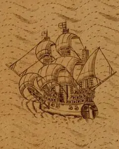
Maps aren’t just about geography. They can also help convey a broader idea of what to expect as you explore what is featured on that map. One way to tell that larger story is through illustrations. Depictions of people, animals, and other images appear on some of the earliest maps. Since these maps were produced during a time of limited literacy, visual symbols were an important – and sometimes only – way to deliver information. Some of those illustrations evolved into decorative cartouches, while others remained to reinforce specific themes, such as danger and the unknown.
Over time, as knowledge of the western Atlantic and North and South America grew those types of images were dropped from cartographic materials. However, in the late 19th century, illustrations and other kinds of images began to reappear on some specialized maps. New printing techniques made publishing in color easier and less expensive, which allowed the mapmaker and printer to add details that would have been difficult and extravagant during an earlier era. This is where the genre of the pictorial map really began, reaching its height in the mid- to late-20th century.